Underground Cities
Mapping the tunnels, transits and networks underneath our feet
This title was previously available on NetGalley and is now archived.
Send NetGalley books directly to your Kindle or Kindle app
1
To read on a Kindle or Kindle app, please add kindle@netgalley.com as an approved email address to receive files in your Amazon account. Click here for step-by-step instructions.
2
Also find your Kindle email address within your Amazon account, and enter it here.
Pub Date 22 Sep 2020 | Archive Date 24 Sep 2020
Quarto Publishing Group – White Lion | Frances Lincoln
Talking about this book? Use #UndergroundCities #NetGalley. More hashtag tips!
Description
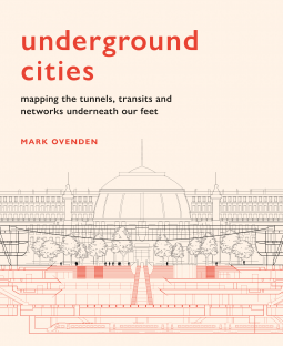
Just how deep do the tunnels go? Where do the sewers, bunkers and postal trains run? And, how many tunnels are there under our streets? Each featured city presents a ‘skyline of the underground’ through specially commissioned cut-away illustrations and unique cartography.
Drawing on geography, cartography and historical oddities, Mark Ovenden explores what our cities look like from the bottom up.
Available Editions
| EDITION | Other Format |
| ISBN | 9781781318935 |
| PRICE | $40.00 (USD) |
| PAGES | 224 |
Average rating from 17 members
Featured Reviews
 John L, Reviewer
I know of books that forensically cover the subterranean London – the tube stations and platforms, sewers, bunker sites, and so much more, and I dare say there are equivalents for many cities if you know where to look. This is the first book I've read that portrays the general underground topology of multiple cities, taking anywhere large enough, impressive enough and interesting enough underground, and giving us all the gen a layman might want. It seems to start a little dryly, with LA, and the numerous street car companies and tunnels and where they went to and from – before you've found the large map accompanying that (and generally every other) city you might not have a foggiest where these things are in relation to anything. Each locale gets a similar treatment – vintage images and modern photography of some of their daylight-free zones, a full map of all the underground territory, and new diagrams, showing certain stations, submerged malls, or suchlike.
I think this is a hit, for it does seem to do what it wants to achieve, but I can't be sure it would get a wide audience. Five pages of text or whatever it is for every city does not provide the detail the spotter and geek would demand, and for anyone else there is a little bit of the trivial in knowing whether Toronto or Montreal are the most complex in their complexes. I think the most interesting thing here is the ghost station, second only to the supposition you get with Moscow and other cities about undeclared vaults, bunkers and tunnels – Tokyo is rife with the stuff, allegedly, but would Moscow really make it easy enough to see their secret second, deeper metro line network by latching it on to their first, or would they have not been forced to, due to lack of access space - and to get the carriages down there in the first place? Interesting items of infrastructure, such as robotic buried bike parks, are certainly of interest. Niche, but of interest – which is also the verdict for the whole book.
"the Richness and Diversity of These Sites"
This is a brisk, wide-ranging, and remarkably entertaining and informative piece of contemporary archaeology/urban design. Our guide is amiable and knowledgeable. While the tone is congenial the author keeps his eye on the subject at hand and the focus remains on the unique and fascinating.
The author has opted to organize the book as a circumnavigation of the globe, (starting in North and, briefly, South America), which adds a cultural and world traveling feeling that you wouldn't have with an alphabetical or similar arrangement.
Each city gets a different sort of treatment depending on what is most of note and interest. Thus, the chapter on Los Angeles is devoted to transportation, while in Mexico City we focus on the dried up lake upon which the city has been built. This approach manages to capture either a familiar aspect of a city's character, or a surprising and little know aspect. This is not merely a survey of the usual suspects, (for example, the London Tube map again). Of course we do lean heavily toward subways and the like; the theme is what's underground and phone cables aren't that fascinating. But our author has taken pains to seek out the odd and unusual as well.
On the matter of illustrations, the approach to drawings and photos seems of special, even primary, importance with a work like this. Here, schematics and cutaway or "exploded" drawings are used very effectively. I would have liked more large format photos, but that's always the case in books like this. And of course there are loads of maps.
Everyone will have favorite urban areas, of course, but I was very much taken by some of the more surprising and/or exotic selections. There weren't many surprise views of the New York City subway system, but Berlin, Helsinki, Budapest, Moscow, Tokyo, and Stockholm were particularly pleasant and intriguing surprises.
So, wildly browseable and deeply edifying, this is a well conceived, well written, and crisply designed and produced volume. An excellent find.
(Please note that I received a free advance will-self-destruct-in-x-days Adobe Digital copy of this book without a review requirement, or any influence regarding review content should I choose to post a review. Apart from that I have no connection at all to either the author or the publisher of this book.)
I love cities and I am interested in public transport, so I devoured this book, but I think it would be a treat for every armchair traveller, especially in this pandemic time, when for many of us it is the only option to get away from everyday life.
Every city is decently described, with many surprising facts cited (I've been to some of this cities but had no idea about many curiosities), and with wonderful pictures, drawings and maps. My only complaint is that it should be at least twice thicker, but I count on the second volume! I am sure that I will come back to it many, many times and will buy copies of it for gifts.
Thanks to the publisher, Quarto Publishing Group, and NetGalley for the advance copy of this book.
Emma M, Reviewer
I am always interested in learning about Underground places. Most of the books that I have read about the subject mainly cover London's Underground transport and also Underground Bunkers.
This book is much more varied as it features Cities all around the world, and not all of the studies are Subways. There are shopping centres, cities, a wide variety of places.
Each place has an extensive amount fillustrations and maps. There are photographs old and new and diagrams. The write-up is sometimes brief, but interesting.
If you have an interest in this subject, then this is an appealing and enjoyable book.
Thank you to Netgalley and the Publisher for my ARC.
 Librarian 68637
A fascinating look at what lies under major cities around the world. The text is insightful and the pictures and drawings are superb.
Kennedy P, Librarian
I enjoyed this book, but I don't think it has widespread appeal. As with any sort of coffe table book, I wish this had more pictures and illustrations.
Jonathan C, Reviewer
Mark Ovenden has made a career of publishing books about transportation systems and their maps that are both comprehensive and copiously illustrated. These include books about transit maps, railway maps and airline maps, as well as books about specific transit systems like the London Underground and the Paris Metro.
His latest, Underground Cities (Frances Lincoln, 22 Sep), is in some ways a natural progression from his past work: in the introduction he muses on the link between transit geekery and wondering about “what else lies down there beyond the walls” (p. 6). But in other ways this is quite a different book.
For one thing, Underground Cities is a book about cities’ underground infrastructure in general: not just subway lines and stations, but pedways, sewers, pneumatic mail systems and other utilities. For another, though maps, diagrams and other illustrations are found throughout this book, it’s about the infrastructure, not the maps.
The book is organized by city: 32 in all, 19 of which are in Europe, starting on the west coast of North America and moving eastward across Europe and Asia. Each chapter has a short essay on the underground infrastructure of the city, and is illustrated by photos (mostly of subway stations) and diagrams. Twenty of the chapters come with more detailed diagrams and maps. There are three types. First, each has a vertical scale showing just how deep the sewers, pipes caverns and subway stations go. Second, there’s a featured three-dimensional cutaway diagram showing the layout of some key facility, like a subway station or shopping mall. (London’s Picadilly station and Paris’s Forum des Halles are absolute standouts here, as are the facilities you wouldn’t expect, like Tokyo’s bike vaults, Helsinki’s swimming hall, or the Boring Company test tunnel in Los Angeles.)
Finally, there’s a two-page map spread of the underground city, which includes subways (and some surface rail lines), sewer lines and pedestrian passages. Each map spread uses a single colour scheme; all subway lines are orange regardless of the colour assigned to them by the official subway maps, which means that the Red Line and the Blue Line are all depicted with orange lines. A dense subway network like Paris’s becomes cluttered and indistinguishable. The map shows that there’s a subway line there, but it’s decidedly not for navigation. It’s an overview. So too is the text an overview, though there are some interesting gems there, like the cheese storage in New York City, and the tunnels carved into the Rock of Gibraltar.
Even with the included photographs, maps and diagrams, compared to some of Mark’s earlier books Underground Cities seems a bit sparse, if only because Transit Maps of the World and Paris Underground (the two books I’ve seen and reviewed) were so lavish and colourful. (Also, 12 out of the 32 cities have no maps or diagrams.) It occurs to me that this is probably a function of its subject matter. Transit systems have maps, posters and other ephemera that can be reprinted; sewer systems, pneumatic tube lines and bomb shelters, not so much. Those systems may (like Moscow’s secret Metro-2, or Tokyo’s mystery tunnels, both of which are tantalizingly and all too briefly mentioned here) be unmappable, though it may simply be that the systems are just unmapped, at least not in an accessible fashion. Rather than reprinting, Mark must have maps (by Lovell Johns) and cutaway diagrams (by Robert Brandt) made for purpose, which is (I’m guessing here) an impediment to going all-out.
For the purposes of The Map Room’s audience, this is not a book where the maps are front and centre; it’s an interesting introduction to a map-adjacent subject, and it’s got interesting maps and diagrams, though not nearly enough of them. This was a pregnant book that left me wanting more: more cities, more maps, more detail in the text and illustrations, as though every chapter ought to have been a book in its own right.
Readers who liked this book also liked:


Jenny Kane
General Fiction (Adult), Mystery & Thrillers